Expedition 51°

The Road Trip along the Quebec Labrador Highway!
Discover a new highway loop that takes you through the northern regions of two provinces on a one-of-a-kind road trip! Designed for enthusiasts of untamed landscapes, this adventure offers an extraordinary experience through a surprising yet beautiful territory!
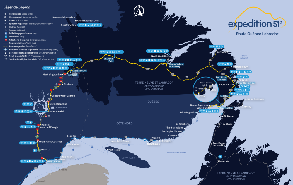
Embark on a single road trip across the North Shore of Quebec and Labrador with this interprovincial circuit. Drive across three legendary routes: Route 389, the Trans-Labrador Highway, and the eastern stretch of Route 138, also known as the Chicoutai Scenic Road.

Over 1,700 km of road trip
2 provinces to discover
Approximately 10 days of adventure
(One-way journey: from Baie-Comeau to Blanc-Sablon)
Along the way, you can visit historical and Indigenous territories, admire impressive hydroelectric plants, discover isolated coastal villages, enjoy whale watching, hike a wide variety of trails, visit the "Iceberg Alley," and explore UNESCO-recognized sites.
Expedition 51 provides a different way to discover the North Shore tourist region and will allow you to traverse Labrador from west to east, reaching Blanc-Sablon on the Lower North Shore. This adventure offers a chance to visit unique attractions where nature and history take the spotlight!
Recommendations:
• Planning: Create your itinerary by considering your chosen mode of transport and the route you plan to take for the return journey (more details are provided at the end of this article).
• Visitor information centres: Ask for details on local attractions and services. Be sure to get the Expedition 51 sticker and printed map. Access the online version of the map here and consult the digital map in this link: https://goo.gl/maps/WSYn9bPrBrsaQW6o8.
Day 1, 2, & 3
Route 389, QC | Baie-Comeau — Fermont (565 km)
The journey begins in Baie-Comeau, where options abound. Spend at least a day exploring the city's diverse experiences and nearby attractions. Enjoy a wide range of restaurants, accommodations, and outdoor activities; including zip-lining, sea kayaking, an outfitter visit, whale watching, etc. After a restful night, get ready to start the adventure beyond the 51st parallel!
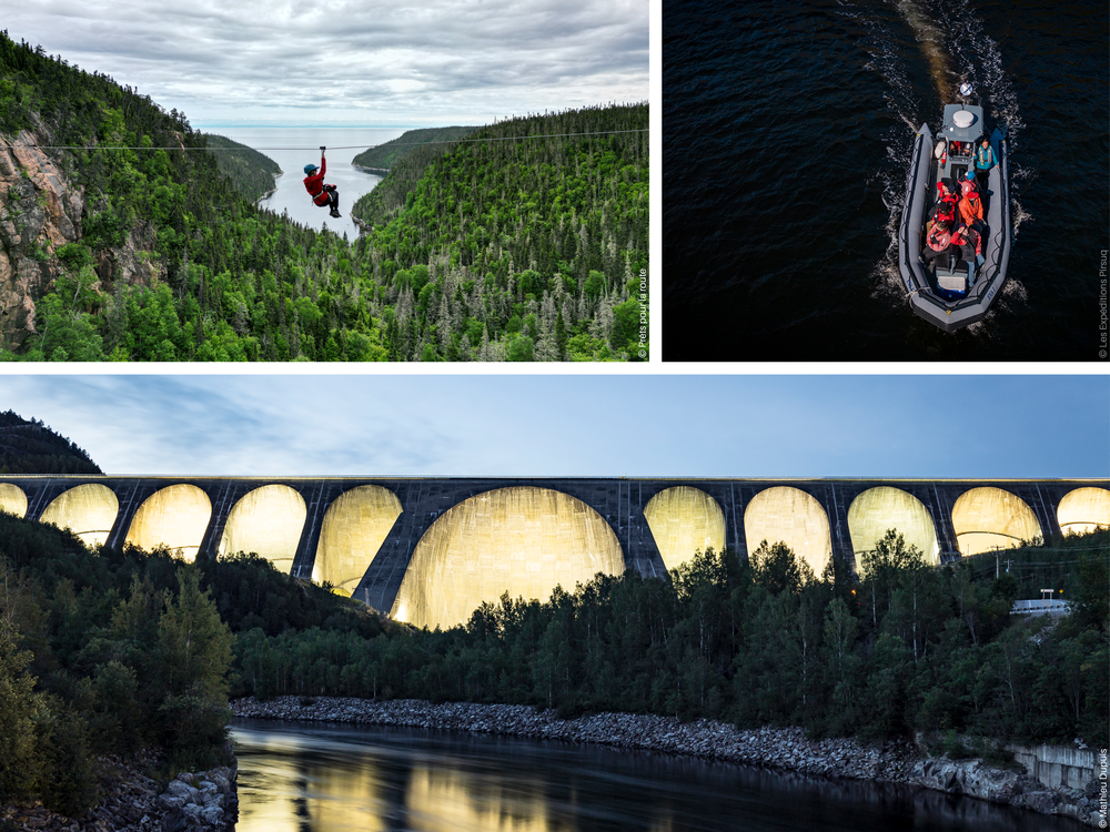
Travel north on Route 389 to see the Jean-Lesage hydropower generating station (Manic-2) as well as the famous Daniel-Johnson dam, also known as Manic-5. Discover more about these engineering marvels during a guided tour. Take a break at one of the rest stops along the route or even better, enhance your trip with a fishing or camping experience.
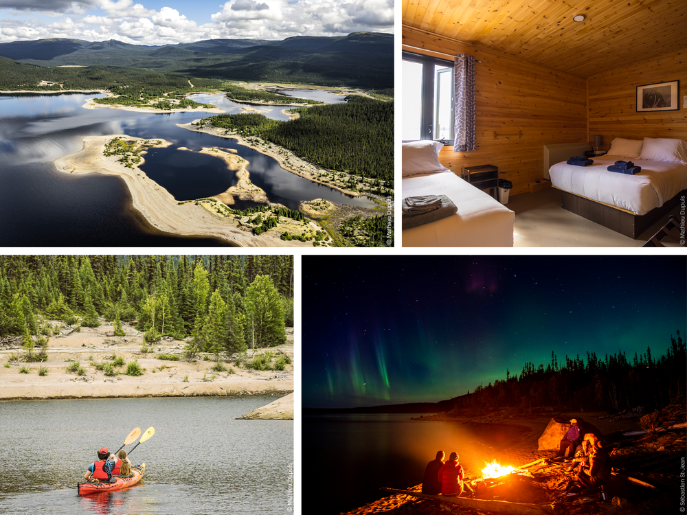
After you pass Manic-5, you'll start to see the Manicouagan Reservoir, famously known as "The Eye of Quebec." To fully appreciate it, consider staying at the Uapishka Station, a base camp nestled at the base of the Groulx Mountains within the Manicouagan-Uapishka World Biosphere Reserve, a UNESCO-designated site. Here, you'll immerse yourself in an authentic northern adventure, engaging in Indigenous cultural experiences and outdoor activities; a must-do!
Continue traveling along Route 389 until you reach Fermont. Here, you can choose from a variety of restaurants and accommodations. As you explore, you'll notice the striking "screen wall"—a 1.3 km-long multifunctional structure designed to shield the town from northern winds. In the summer, the MRC Caniapiscau offers guided tours of the impressive Mont-Wright mining complex. You can also join local guides to discover the surrounding area. Be sure to visit the summit of Mont Daviault for breathtaking views of the town, and if you're up for an adventure, explore the hiking trails in the Severson Mountains.
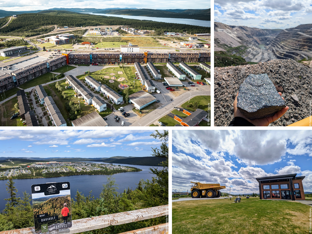
Condition of Route 389: partially paved. Out of the total 565 km, 167 km consists of gravel, divided into two sections: 100 km between Manic-5 and Relais Gabriel, and 67 km between Fire Lake and Mont Wright. Vigilance and caution are required. QC 511 - Route 389.
Day 4 & 5
The Trans-Labrador Highway - Route 500, NL | Labrador City — Happy Valley-Goose Bay (529 km)
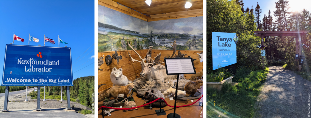
After leaving Fermont, you will reach the border of the province of Newfoundland and Labrador where Route 389 becomes Route 500. Once in Labrador City, it's worth stopping at the Gateway Labrador to explore the Edmund Montague Exhibition Hall and delve into the region's history. Nearby, enjoy a leisurely walk at the Tanya Lake Trail beach or explore the Menihek interpretive trails. Check out local accommodations and dining options to prepare for the next leg of your journey on the Trans-Labrador Highway.
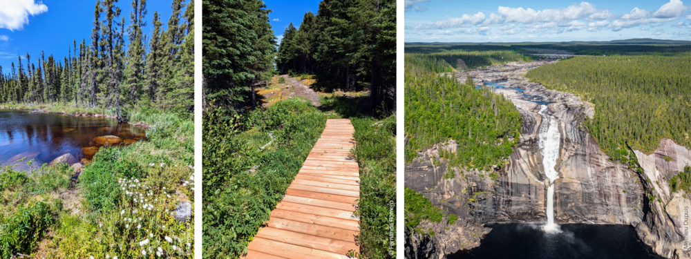
From Labrador City, Route 500 meanders through lakes and forests until reaching Happy Valley-Goose Bay. Along the way, you'll pass through Churchill Falls, a small town centered around hydroelectric facilities. A highlight here is the impressive Churchill Falls, you can stretch your legs and follow the Bowdoin Canyon Nature Trail for less than 3 km to view the Churchill Falls which drop more than 300 m!
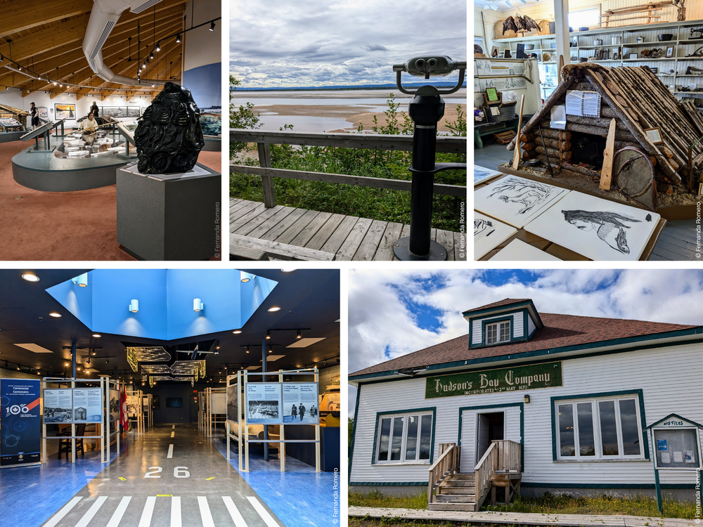
In Happy Valley-Goose Bay, take the time to visit the Labrador Military Museum, browse local art shops, and stroll along the Birch Island Boardwalk—a 5 km wooden pathway that travels through various ecosystems. You also have the option to go further north by taking Route 520 to the village of North West River, a unique place where you can visit the Labrador Interpretation Centre and the Labrador Heritage Society Museum, which are true gems of the area.
Day 6, 7 & 8
The Trans-Labrador Highway - Route 510, TNL | Happy Valley-Goose Bay — L'Anse-au-Clair (612 km)
Continue your journey along Route 510 to Port Hope Simpson, the starting point of the Labrador Coastal Drive, which heads south along the coast of Labrador. Spend the night here and take the opportunity to go on an interpretive tour of the community. A short detour on Route 513 leads to St. Lewis, where you can have the first glance of the "Iceberg Alley," the seasonal path of icebergs drifting from Greenland along the coast from spring to early summer.
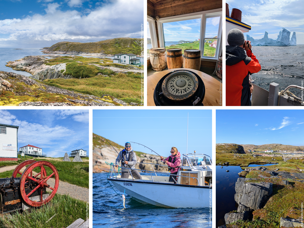
Next, you'll reach Mary's Harbour, the gateway to the Battle Harbour National Historic District. Take a boat to Battle Harbour Island, which is accessible during the day, but it is highly recommended to spend at least one night to fully experience the magic of this place. Locals will guide you and share the fascinating history of this ancient fishing village. Each building is a museum and activities abound; traditional bread-making workshops, hiking on the islands, boat excursions offering marine wildlife observation, cod fishing, and iceberg hunting!
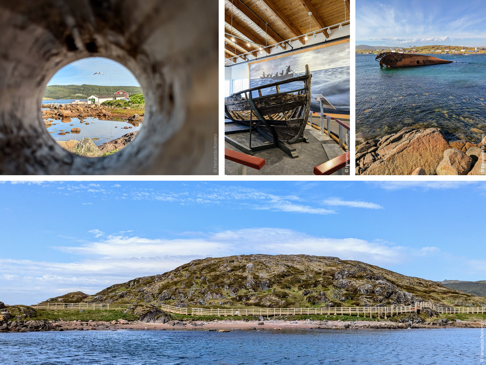
Before leaving Mary's Harbour, grab a coffee at Caribou Place, a craft shop and art gallery run by an Inuit artist. Then, head to Red Bay National Historic Site, a UNESCO World Heritage site. Learn about the Basque whalers who visited the area in the 16th century. After a visit to the interpretation center, explore Saddle Island to see a historic shipwreck and learn more about it from a Parks Canada interpreter. Spend the night in Red Bay and enjoy the local favorite, "Fish & Chips," at Whaler's Restaurant & Cabins.
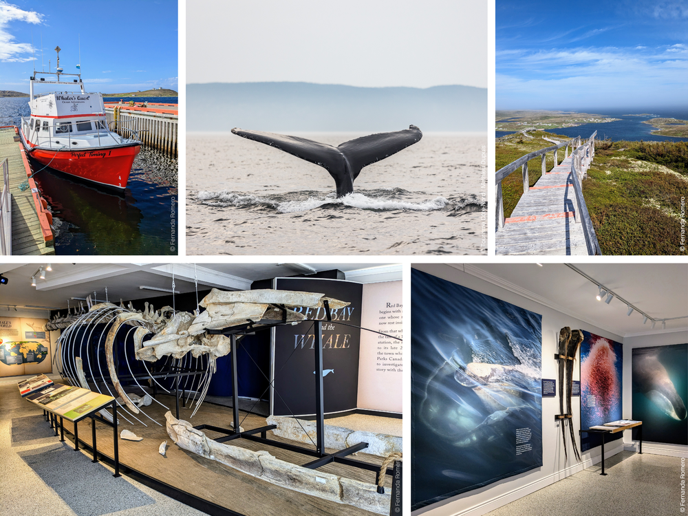
During the day, take a tour with Whaler's Quest, a family-run operation offering boat trips around Red Bay where you might spot icebergs and whales. Before or after the boat tour, visit the Right Whale Exhibit Museum to see a reconstructed skeleton of a 17-meter-long North Atlantic right whale, estimated to be over 400 years old! On the opposite side of the bay, you can hike the Boney Shore trail or Tracey Hill to enjoy the breathtaking view of Red Bay from the summit.
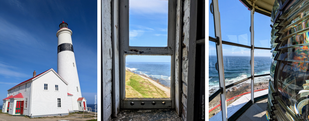
As you continue, consider adding a fishing trip on the Pinware River. For the final stretch of the Trans-Labrador Highway, make a stop at the L'Anse-Amour National Historic Site which is home to the tallest lighthouse in Atlantic Canada, the Point-Amour Lighthouse. Climb to the top for panoramic views of the Strait of Belle Isle. Your journey on the Big Land concludes in L'Anse-au-Clair, the last village in Labrador. Here you can hike the Jersey Trail, visit the beach, or explore part of the Labrador Pioneer Footpath, a network of traditional trails connecting the villages.
Condition of roads 500 and 510: fully paved. The paving of the Trans-Labrador Highway was completed in July 2022. On road 510 you will find two Wi-Fi access points (Site 1 and Site 2). More information: Transportation and Works.
Day 9 & 10
Route 138, QC | Blanc-Sablon — Old Fort Bay (150 km round trip)
Just a few kilometers ahead, you'll cross back into Quebec, marking the start of the final leg of Expedition 51: the Chicoutai Scenic Route along the Lower North Shore. This route will lead you to Old Fort Bay on the extension of Route 138, which meanders along the coast, offering stunning coastal landscapes!
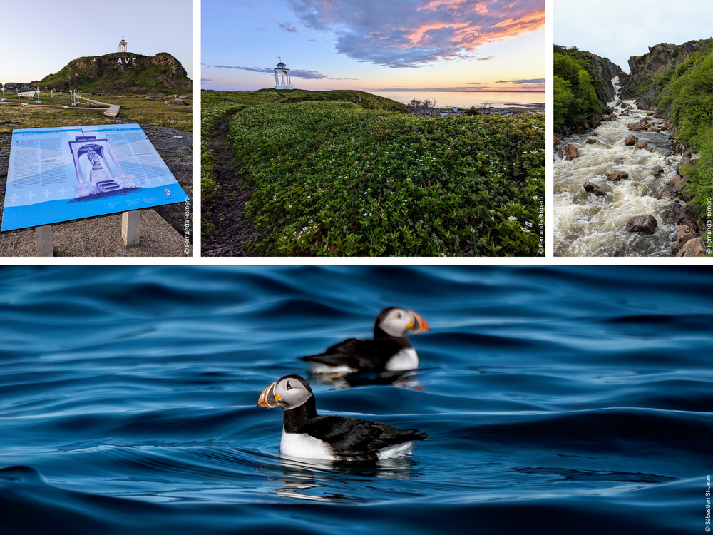
Take some time to explore the accommodations, dining options, and local attractions along this route. Before reaching Old Fort Bay, consider hiking up to the Notre-Dame-de-Lourdes shrine for panoramic views of Blanc-Sablon and explore the scenic trails at the summit. Additionally, you can visit the Perroquet Island lookout; an observation site with a telescope to watch seabirds. You will find one of Quebec's largest puffin colonies there! Continue the journey and stop to see the Brador Falls at the roadside lookout.
Another must-do experience is Salmon Bay Farm, where you can experience scallop farming and discover the bay by guided boat tours or kayak excursions. Continue to the charming village of St. Paul's River and visit the Whiteley Museum, which offers a deep dive into local history. Enjoy a local meal at the Cod Trap Café and engage with residents who are passionate about their heritage! If the weather permits, consider a boat excursion to further explore the territory.
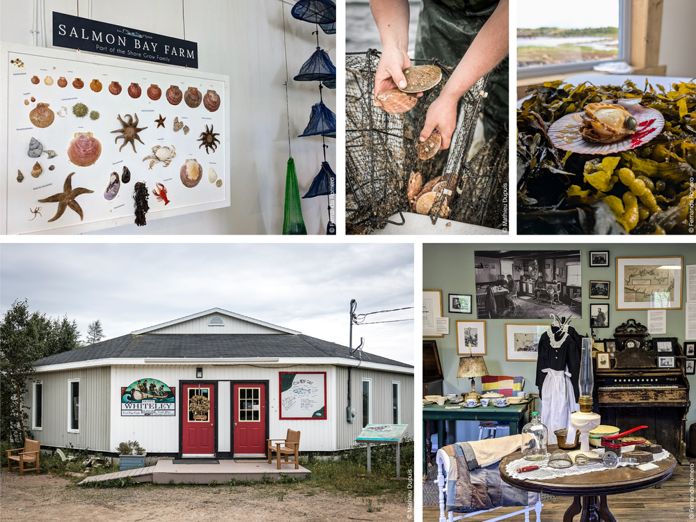
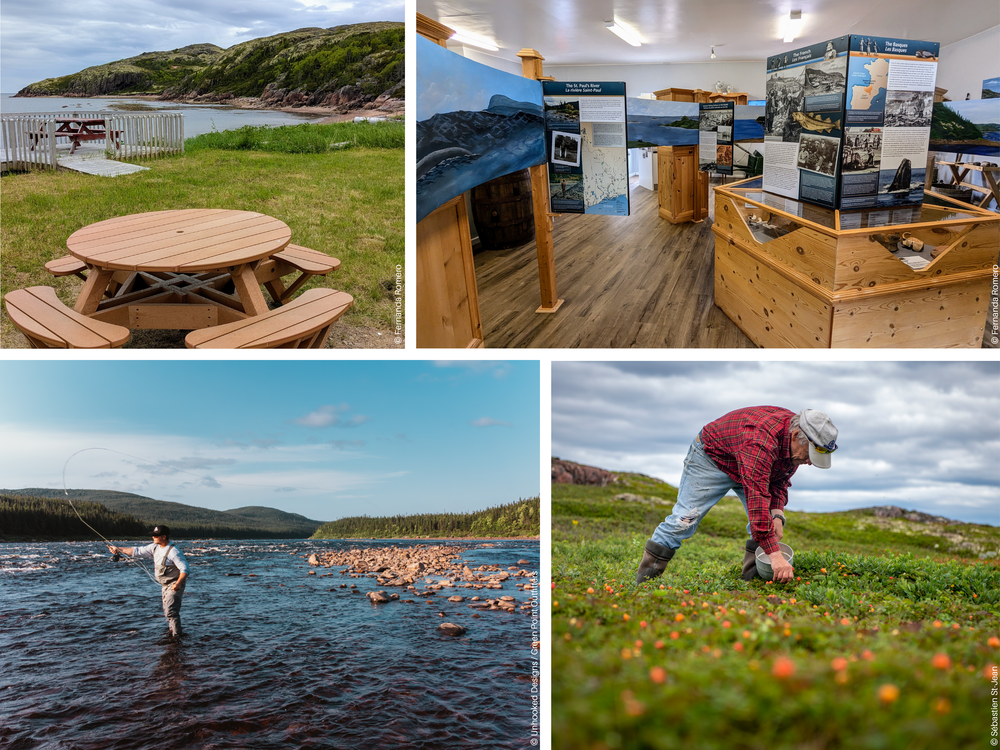
You may also choose to experience fishing—either freshwater or saltwater—with Green Point Outfitters. About ten kilometers from St. Paul's River, you'll reach Old Fort Bay, the last village on the circuit. To complete Expedition 51, head back to Blanc-Sablon. On your way back, visit the Middle Bay Interpretation Center to delve into the region's history and heritage. Here, take a break from the road and enjoy a local meal with a view of the Gulf of St. Lawrence at the Crossroads Café.
Once back in Blanc-Sablon, make sure to explore the area thoroughly before departing. Visit the Monseigneur Scheffer Museum or hike the Milk-Vetch Trail, which leads to the summit of Mont Parent Hill. Check out opportunities for whale watching, seabird watching, and iceberg hunting! You might also pick wild fruits like cloudberries (known as chicoutai in French), which are used in local dishes, and lend their name to the route you've traveled: the Chicoutai Scenic Route.
Condition of Route 138: fully paved (from Blanc-Sablon to Old Fort Bay). QC 511 - Route 138.

Completing the loop.
From Blanc-Sablon, you have three options:
1. Retrace your steps back to your starting point.
2. Take the ferry to St. Barbe on Newfoundland's island to explore the west coast and visit Gros Morne National Park, then continue to Nova Scotia and Quebec's Bas-Saint-Laurent.
3. Board the Bella Desgagnés, a passenger and cargo ship that stops at the Lower North Shore villages before arriving in Natashquan. From there, you can continue exploring the North Shore via the Whale Route.
By Fernanda Romero, Interprovincial Tourism Coordinator.
Expedition 51° - Interprovincial partnership with Tourisme Côte-Nord.
